What a Drone Sees at the Edge of a Glacier
At the edge of a South Greenland glacier, a fragile drone becomes a vital research partner. Joining natural scientists in the field, DIAS Chair Kathrin Maurer offers a humanities perspective on how drone technology shapes knowledge, care, and attention in climate research — revealing not just a changing landscape, but the deeply human relationships behind the science.
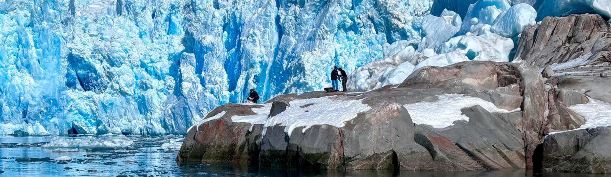
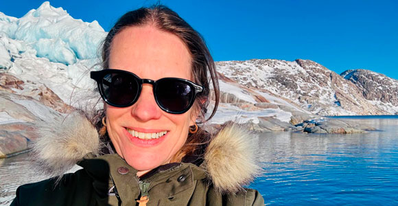
On a clear blue day in South Greenland in mid-April, a small boat drifts near the edge of a glacier. The water is calm, the sky wide and open, and the ice rises in immense stillness.
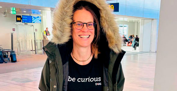
It is, as DIAS chair Kathrin Maurer, professor at SDU and Fellow at the Nordic Humanities Center, recalls with a smile, “an absolutely beautiful landscape… I had never seen anything like it.”

But the researchers on board are not there to admire the view for long. They are there from the Geological Survey of Denmark and Greenland (GEUS) and Aarhus University’s Centre for Ice-Free Arctic Research (CIFAR), and by measuring glacier water, they hope to gain crucial data about climate change. The project was funded by the Novo Nordisk Foundation and CIFAR.
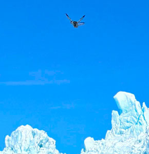
At a distance, carefully measured for safety, a drone lifts into the air. The glacier is too dangerous to approach closely. Ice calves without warning. Boats keep their distance. But the drone can move in, hovering near the glacier front, lowering a sampling device into the water below, or take images of the topography higher up.
From there, it begins its work.

A different kind of observer
Maurer did not join the expedition as a natural scientist like the rest of the expedition members. She joined as something else entirely: a humanities professor, who has worked a lot on the aesthetics of drone sensing and drone art, embedded in a scientific field team.
Her role, as she describes it, was to observe not just the landscape, but the relationship between researchers and the technology they rely on.
What she encountered was not a seamless, high-tech operation, but something far more fragile, and far more human.
“They were so dependent on the technology,” she says. “Everything was contingent upon whether it would work.”
Equipment had to be transported over long distances, and tools were improvised in the field. One researcher wrapped the drone in a towel to protect it on the boat, while another carried it under his arm, navigating uneven terrain to find a place to launch. They were really attached to it.
At one point, a device was lost to the water. At others, parts had to be repaired on the spot. The work was shaped as much by weather, logistics, and chance as by planning.
“It was always a bit like: hopefully this works,” Maurer says. “The drone technology was not this super-precise, autonomous system. It was fragile.”

…and a different kind of drone
Drones are often associated with distance, surveillance, or warfare. But in this setting, Maurer encountered something that challenged that image.
“There was a certain tenderness about this technology,” she reflects. “It sounds strange, but the drone didn’t feel like something cold or aggressive. It was kind of taking care of the landscape, almost hugging it.”
Rather than observing from above as a detached “eye in the sky,” the drone moved close to the glacier, responding to its contours and conditions. It became part of a careful, almost attentive interaction with the environment.
For the natural scientists, its purpose was clear: to collect data. The drone enables access to areas that would otherwise remain unreachable, capturing water samples that reveal how meltwater flows beneath and in front of the glacier, carrying nutrients and reshaping marine ecosystems.
For Maurer, however, the drone raised a different set of questions.
“It’s what I would call an epistemic technology,” she says. “It doesn’t just collect data, it shapes how we come to know this environment.”
Seeing differently
One of the most striking aspects of the drone’s perspective, Maurer notes, is what it does not do.
It does not aestheticize the landscape in the way a human observer might. It does not turn the glacier into something sublime or picturesque. Instead, it captures traces, data, material changes, signs of transformation.
“The drone shows the materiality of nature,” she explains.
This machine-generated perspective shifts the gaze away from human interpretation. It reveals a landscape in flux, less a spectacle than a system under pressure.
At the same time, it is not a perfect or all-seeing technology.
Much of Maurer’s own research focuses on the limits and blind spots of technological systems such as drones. In Greenland, she saw those limits up close.
“We often think of drones as this kind of super-technology,” she says. “But they have glitches. They fail. They depend on so many people and conditions.”
Pilots, technicians, drivers, weather conditions, timing - everything plays a role. The drone is not autonomous, it is part of a network.
“It’s not something that just works on its own,” she adds. “There are always people behind it.”
Between perspectives
The expedition also revealed a gap - and a meeting point - between disciplines.
While Maurer was interested in the cultural and political dimensions of drone technology, the natural scientists approached it primarily as a tool for knowledge production.
“They didn’t really see it as an aggressive or invasive technology,” she says. “For them, it’s about understanding the glacier, the ocean, the ecosystem.”
Their focus is on what happens beneath the surface, how meltwater escapes from the glacier even in colder seasons, how it interacts with warmer ocean currents, and how these changes affect marine life.
At the same time, the work is not isolated.
The team collaborates with the Greenland Institute of Natural Resources and draws on long-standing relationships in the region. There is an awareness of place, of local knowledge, and of the need for respect.
“It wasn’t what you might call ‘hit-and-run research,’” Maurer notes. “There was a sense of continuity and connection.”
A place of tensions
Beyond the scientific work, Maurer also sought to understand the broader context in which it unfolds.
Greenland is not only an environment shaped by climate change, it is also a place marked by political, cultural, and social dynamics.
During her time in the town of Narsaq, Maurer connected with a local youth center, where art projects brought together young people navigating uncertain futures.
“They talked about worries - about the future, about politics, about what will happen,” she says.
At the same time, she encountered a different kind of response elsewhere. Fatigue.
In Nuuk, signs in museums asked visitors not to inquire about the political situation. Researchers and journalists had come in large numbers. Not all questions were welcome.
“There was a sense of: leave us alone,” Maurer recalls. “And that also has to be respected.”
These encounters added another layer to the experience, one that sits alongside, but not always within, the scientific work itself.
What remains
Returning from Greenland, Maurer carries with her a renewed sense of what drone technology can be, and what it is not.
“It’s a dual technology,” she says. “It has this association with war, but it can also be used for climate research, for sustainability, for understanding marine life.”
That ambiguity remains central to her work.
At the same time, the experience has opened new directions. As a visual culture scholar, Maurer is now interested in the images produced by the drone, their aesthetics, their perspective, and the way they reshape how we see the natural world.
And perhaps most of all, the trip offered a glimpse into a different way of doing research.
In contrast to the solitary rhythms often associated with humanities work, the field team operated as a tightly coordinated unit, dependent on each other, adapting in real time, learning through trial and error.
“They were constantly trying things out,” Maurer says. “It wasn’t that they had all the answers.”
At the edge of the glacier, knowledge is not simply extracted.
It is assembled, carefully, collectively, and always under changing conditions.