Invasive plant species is a huge societal cost, estimated to about 20 bill. € per year in Europe alone. Much of this cost could be avoided by improving plant detection and mapping them before population establishment. This is however not feasible manually.
With InvaDrone, we will develop automated drone technology and image analysis to detect invasive species in the landscape.
Project Goal
Develop technologies that allow us to produce accurate and detailed maps of invasive plant distributions for use in management decisions.
First we work with a small number of Danish municipalities. The technological developments have applications beyond biological monitoring.
Project Details
Develop efficient methods to:
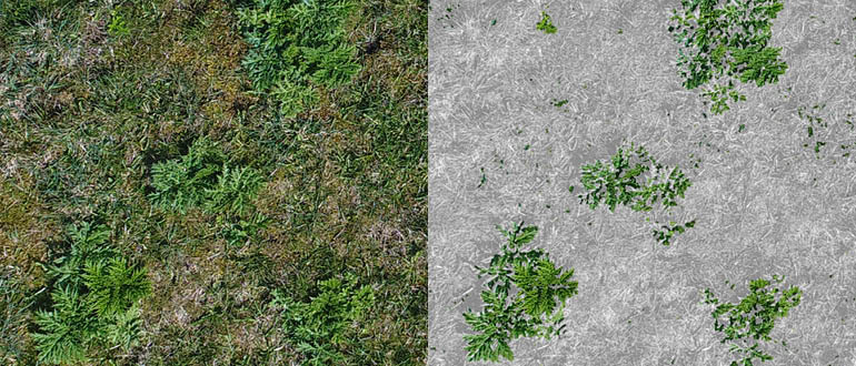
- Teach computers to recognize individuals of focal species and map their position, size and reproductive status
- Allow drones to carry out on-board computing to automatically modify their flight path to take close-up images of objects of special interest
- Apply this technology to enable early detection of invasive species.
Future Perspective
Invasive plants are a global problem and the tools we develop in the project will therefore be useful worldwide. The approach will be generalized to be implemented on a wide range of species in different environments.
The technology developed in this project has potential uses beyond invasive species. Same technology can be applied in fields such as search & rescue, building inspection etc. and the software will be developed with these cases in mind.
PDF presentation of the InvaDrone project.
Media
Drones go into the fight against invasive species, www.sdu.dk(in Danish)
Drone maps giant hogweed, February 2019, Gartner Tidende, Original title: "Drone kortlægger kæmpebjørneklo"
Contact information
Henrik Skov Midtiby, hemi@mmmi.sdu.dk, SDU UAS Center.