Agave-projektet er afsluttet
Agave Projekt - omfavner fremtiden inden for geomodellering
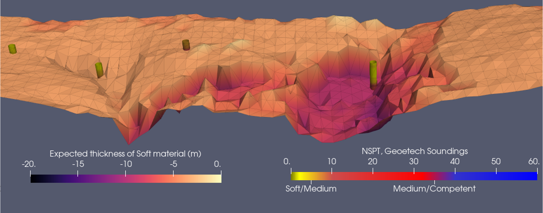
AGAVE's objectives included the reduction of equipment size and weight, enabling the application of measuring instruments by UAVs or drones. Through the integration of a high-resolution ground investigation workflow, featuring a geoscanning system carried by a UAV, machine-learning-based data integration, and a significantly scaled-back invasive sampling program, the project seeks to elevate sustainability in the construction sector. Harnessing drone-based technology will enable flights at lower altitudes, thereby enhancing measurement accuracy and resolution in the initial meters of the subsurface.
”For more than ten years, we have repeatedly delivered and proven the value of airborne geoscanning in large-scale infrastructure projects worldwide. At the same time, we continuously face the challenge of not being able to serve the vast market of small- to medium-scale projects due to the comparably high helicopter costs. A future scenario with less costly drone-based solutions will open that market and enable us to increase efficiency in such projects and contribute to more sustainable infrastructure planning and construction.
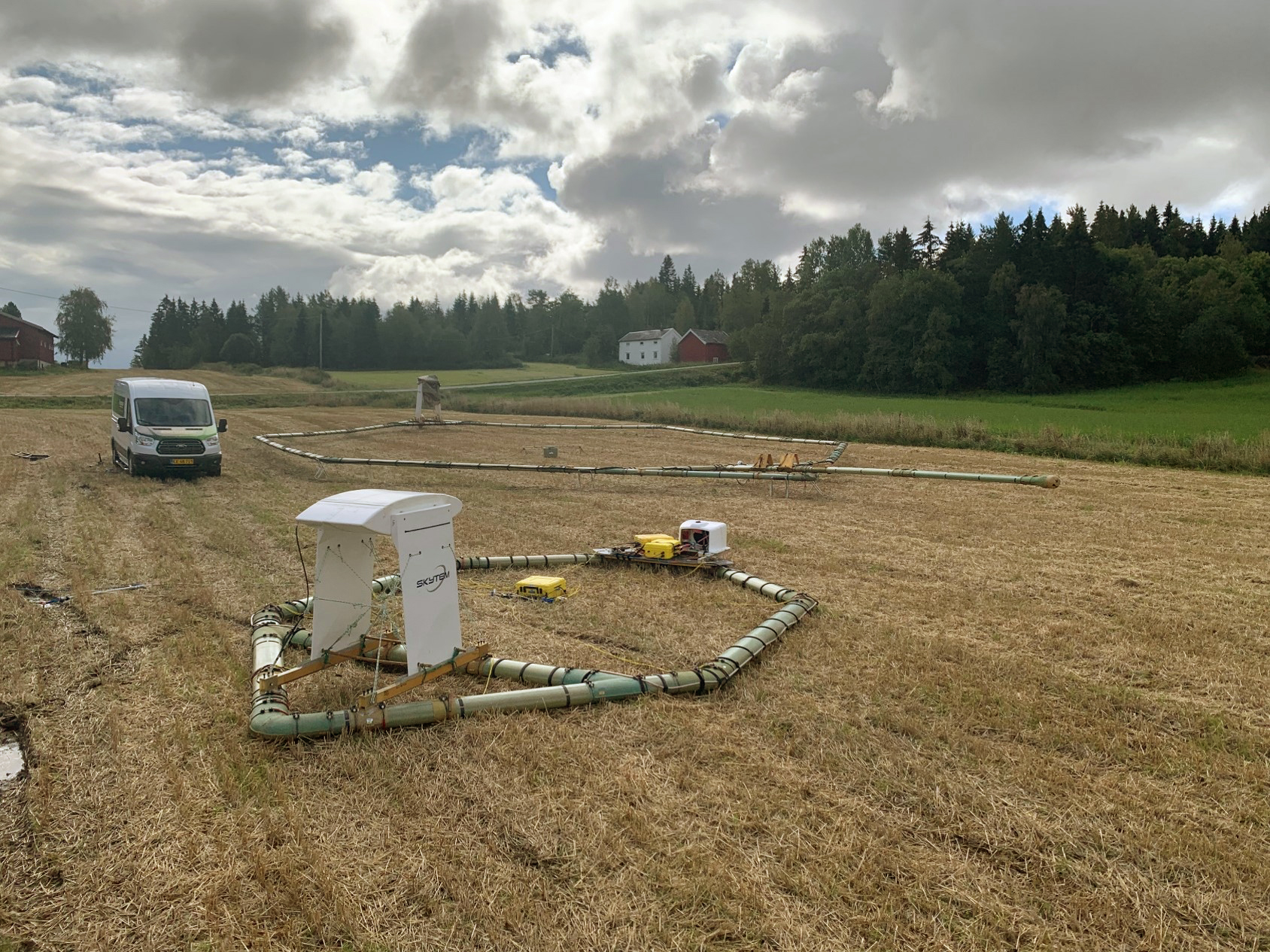
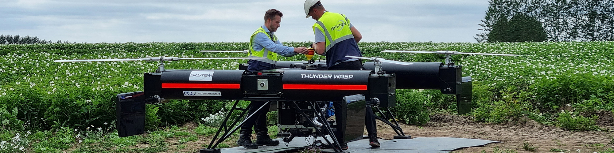
Throughout the AGAVE project, two pivotal achievements have significantly advanced the development of the drone-based system. Firstly, obtaining approval for flying the drone system is a noteworthy milestone, representing, to the best of our knowledge, the first instance of its kind in Europe. This accomplishment, led by project partners SkyTEM and SDU, was corroborated during field tests in Denmark. The data acquired from the drone demonstrated superior resolution compared to data collected from the same location using ground-based geophysical methods. System tests conducted in Norway and Denmark displayed the capacity to present real-world data with the current version of the instrument. This outcome, validated and deemed a notable achievement within the project, was particularly highlighted during geotechnical assessments carried out by project partner NGI in Norway. Notably, a representative smaller system was tested using a helicopter, displaying the versatility and applicability of the new generation results.
”Achieving successful approval for the Specific Operations Risk Assessment (SORA) of such an intricate and heavy-duty platform and payload feels like a dream coming true. Just a few years ago it would have been considered impossible to get permission to operate such a system.
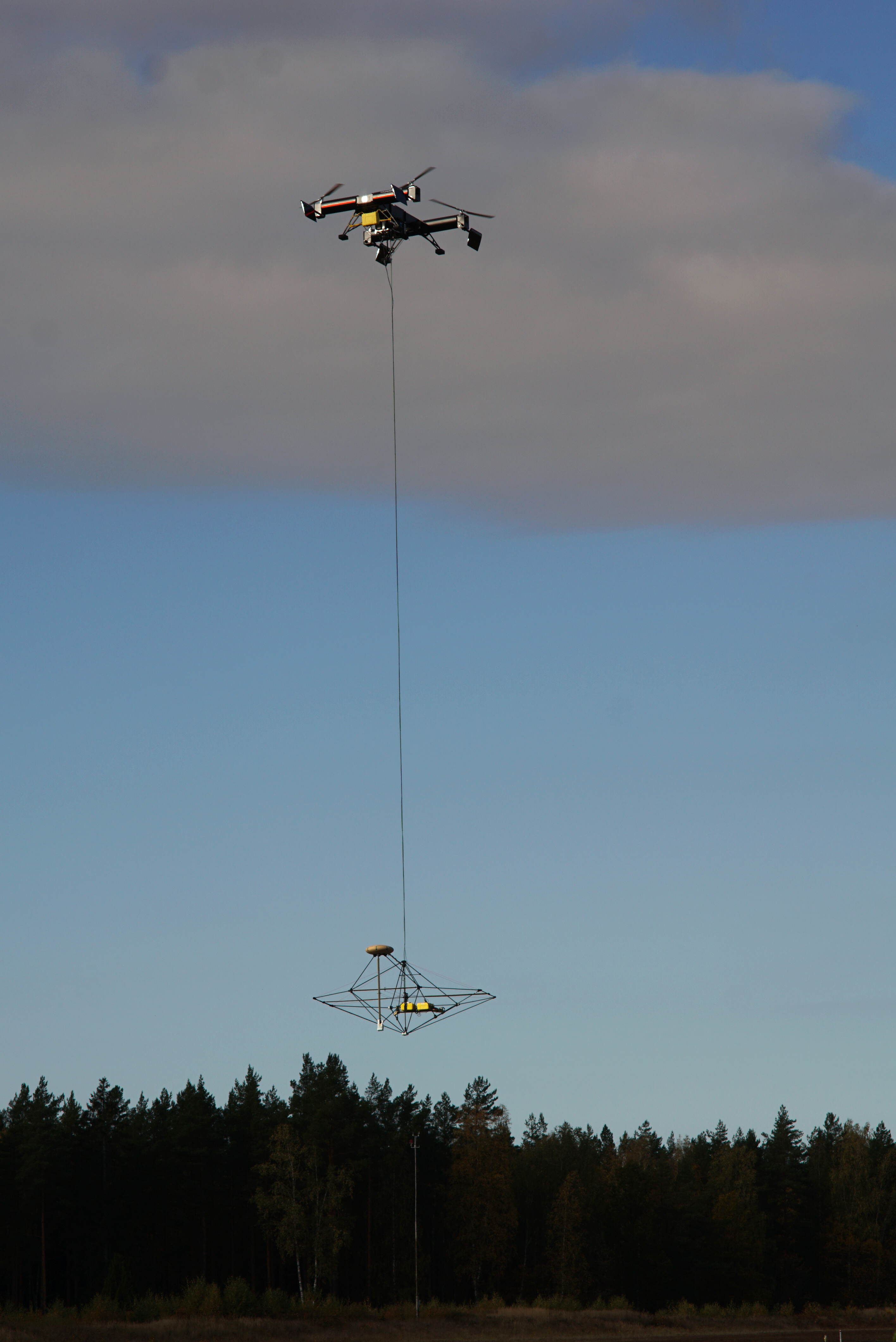
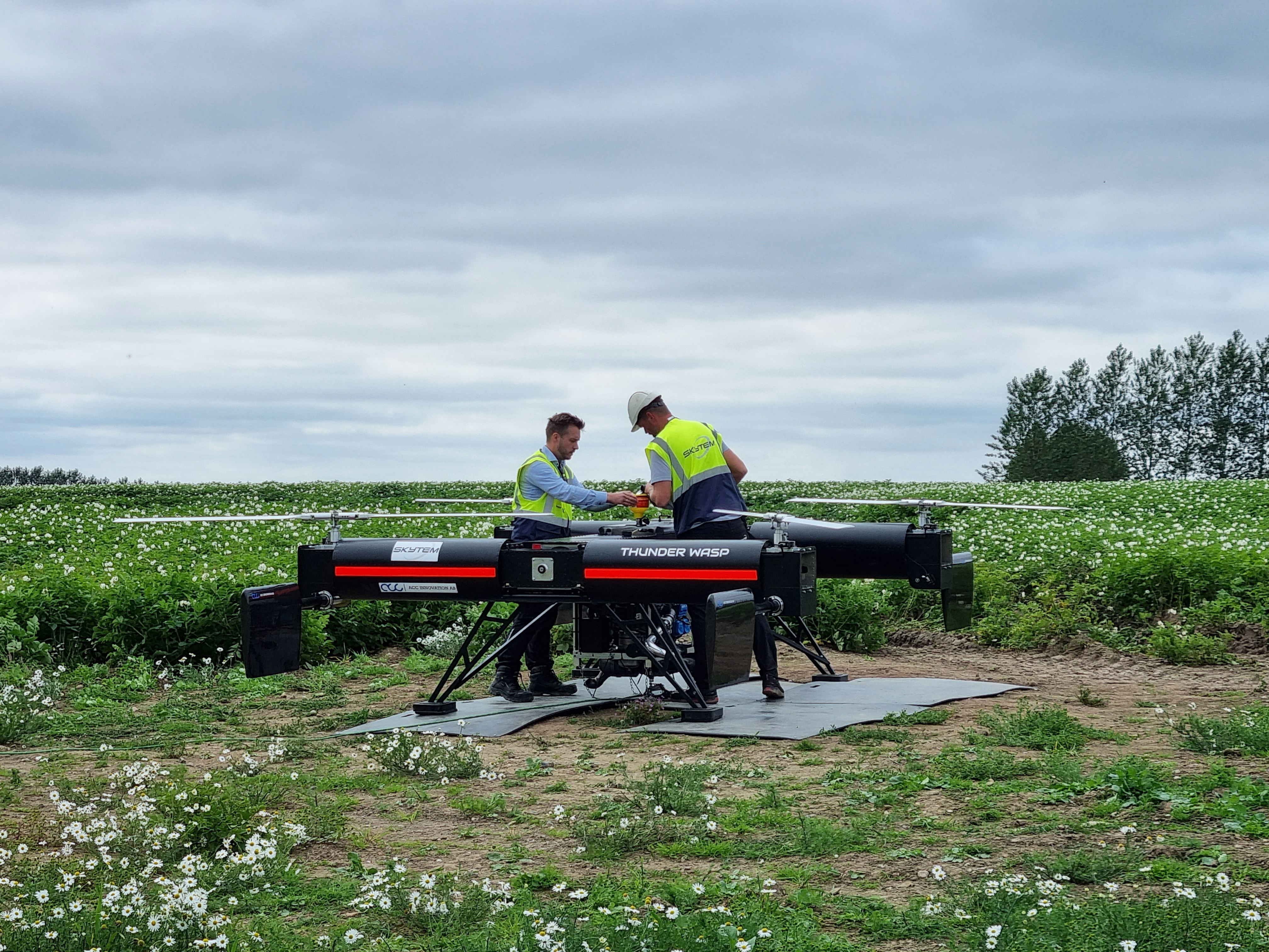
”Pilot tests with the prototype systems have confirmed what we had hoped for: The smaller system, the lower flight altitude and new machine learning workflows provide better resolution and accuracy than we previously got. This is a cornerstone for real-life application of drone-based systems in geotechnical works.
The road ahead
The system has already received approval in Denmark, and the next phase after AGAVE involves transferring the approval to Norway over the next year, in collaboration with project developers and contractors. Once fully developed, EMerald aspires to elevate the system to become the new standard for geotechnical investigations, thereby reducing service costs and increasing the sustainability of infrastructure investments.”Drone-based survey systems are a turning point in our industry and remind us of the paradigm shift caused by the introduction of helicopter-based TEM, which disrupted the fixed-wing TEM market. It makes surveys more financially accessible for smaller-scale projects and demonstrates our dedication to our mission of promoting sustainable surveying.
”The key element of the combined value chain starting with SkyTEM’s high-definition geophysical data and ending with EMerald’s ML–crafted 3D models is to provide subsurface information simply and rapidly. Scaling this value proposition in the coming years powered by a transition from helicopters to UAVs has the potential to disrupt.
Part of the Eurostar Program
The Eurostar program, a joint program between EUREKA and the European Commission, is designed to support innovative projects led by research and development performing small and medium-sized enterprises. Supported by funding from the European Union through Horizon 2020, this program empowers small enterprises to accomplish remarkable things.The pioneering AGAVE project initiative and the partnership of Emerald Geomodelling, SkyTEM, SDU and NGI was supported by Eurostar funding, acknowledging the need for wider spread geological understanding of the earth beneath our feet, supporting more sustainable solutions.